Best Apps for Great Loop Cruisers 2026: The Complete Tech Stack That Actually Works
Quick Summary
- ✓The essential Great Loop app stack includes two navigation apps for redundancy (Aqua Map for community data, Navionics for depth accuracy), weather forecasting (Windy), and comprehensive boat management (YachtWyse).
- ✓AGLCA membership at $150/year provides access to the Harbor Host network and app, which experienced Loopers cite as invaluable for local knowledge and recommendations throughout the journey.
- ✓Great Loop cruising requires apps with strong offline functionality for remote sections like the western Erie Canal, Tenn-Tom Waterway, and Trent-Severn where cell service is limited or nonexistent.
- ✓Budget $500-800 annually for essential apps, though this investment eliminates guesswork and prevents expensive mistakes like running aground due to outdated chart data or missing hazard markers.
Quick Summary: The App Stack That Survived Our Great Loop
At a Looper rendezvous in Mackinaw City, 15 cruisers gathered in the marina pavilion to share tips. Someone asked, "What apps are you using?"
Everyone pulled out their phones. The result: 15 different combinations of apps, overlapping in some areas, completely different in others. Some cruisers had six navigation apps. Others relied on a single chartplotter and paper charts. Some tracked maintenance in spreadsheets. Others used napkins and memory.
After 11 months and 6,000+ miles on our Great Loop journey, here's the app ecosystem that actually worked for us—the ones we used daily, the ones that saved us money or stress, and the ones we wish we'd discovered sooner.
Navigation Apps (Must-Have)
Primary: Aqua Map ($140/year) — Best for Great Loop due to Looper community contributions showing hazards, anchorages, and route notes. Works offline. Syncs with chartplotters.
Backup: Navionics Boating ($100/year) — Industry-standard charts, excellent depth data, route planning. Syncs routes to most onboard chartplotters.
Why two? Redundancy. When one app shows conflicting depth data or hazard markers, cross-reference with the second. On rivers and ICW, community-sourced data (Aqua Map strength) matters more than official charts (Navionics strength).
Weather Apps (Essential)
Primary: Windy (Free with $20/year premium) — Best wind, wave, and precipitation forecasting. Layer views show multiple models. Offshore routing capabilities.
Secondary: NOAA Weather (Free, built-in iOS) — Quick radar checks and NWS marine forecasts.
Community & Planning Apps
AGLCA App ($150/year AGLCA membership) — Official America's Great Loop Cruisers' Association app. Shows route, Harbor Hosts, sponsor discounts, "Best of the Loop" stops. Worth the membership fee for Harbor Host network alone.
Waterway Guide ($80/year) — Detailed marina info, fuel prices, bridge heights, lock schedules, facility amenities. More comprehensive than ActiveCaptain for Loop-specific planning.
Nebo (Free) — Social boating app. Find other Loopers nearby, get recommendations, share favorite anchorages. The flag icon feature helped us identify fellow Loopers throughout our journey.
Boat Management & Maintenance Apps
YachtWyse ($20/month) — Comprehensive boat management: maintenance tracking with hour-based alerts, AI diagnostics, expense tracking with OCR receipt scanning, checklists with voice control, equipment registry with manuals. The app that saved our transmission (see our maintenance blog post).
Alternatives: Vessel Vanguard, YachtWave, Boating Suite (each with different strengths—see detailed comparison below)
Utilities & Practical Apps
Dockwa (Free) — Marina reservations system. Works like Expedia for marinas. No booking fees. Essential for planning ahead in high-demand areas (Chesapeake, Georgian Bay, popular Looper stops).
Snag-A-Slip (Free) — Alternative marina booking app. Owned by Marina Life Company. Sometimes has marinas Dockwa doesn't, and vice versa. Use both for best coverage.
MarineTraffic (Free with $5/month premium) — AIS vessel tracking. See commercial traffic, identify approaching vessels, track friends on the Loop. Premium version shows more detail and history.
Lock Status (Free) — Real-time lock operating status for major systems (Corps of Engineers locks). Saves hours of waiting by showing closures, delays, and maintenance schedules.
Total Annual Cost for Essential Apps
| App Category | Choice | Annual Cost |
|---|---|---|
| Navigation (primary) | Aqua Map | $140 |
| Navigation (backup) | Navionics | $100 |
| Weather | Windy Premium | $20 |
| Community | AGLCA membership + app | $150 |
| Planning | Waterway Guide | $80 |
| Boat Management | YachtWyse | $240 |
| Utilities | Dockwa, Snag-A-Slip, MarineTraffic Premium, Lock Status | $60 |
| TOTAL | $790/year |
Budget cruiser alternative (free/cheaper): Use Aqua Map only ($140), free NOAA weather, AGLCA membership for community ($150), free Nebo for social, YachtWyse for management ($240). Total: $530/year
Bottom line: The right apps eliminate guesswork, save hours of planning time, prevent expensive mistakes (like taking the wrong channel and running aground), and provide an AI-assisted safety net for maintenance issues. Every dollar spent on apps returned 10x in saved time, fuel, and stress.
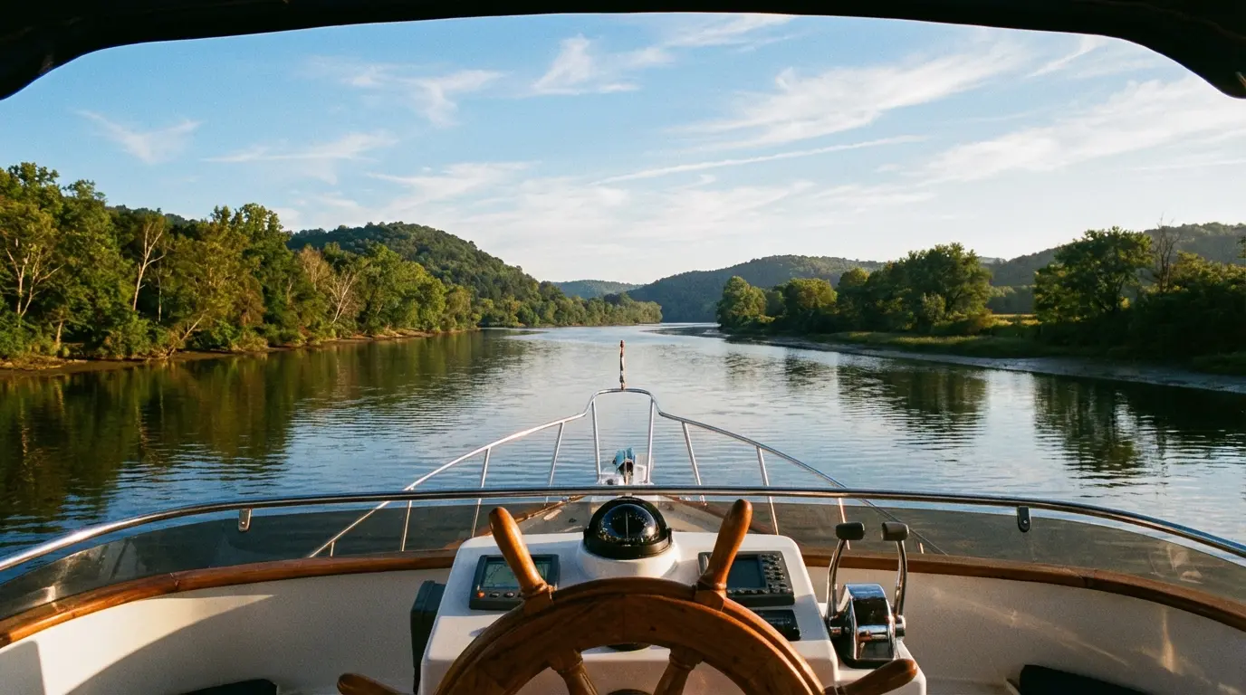
It was our third day on the Great Lakes, somewhere between Mackinaw City and De Tour Village, when I realized my navigation setup was completely inadequate for the Loop.
We'd left Florida with confidence. I had a 10-year-old Garmin chartplotter mounted at the helm, Navionics on my iPad as backup, and paper charts for the areas we'd be cruising. This system had worked perfectly for years of weekend cruising in Tampa Bay.
But the Great Loop exposed every gap in that setup within the first month.
The chartplotter showed Lake Huron beautifully but had almost no detail for the Tennessee River (where we'd started our Loop). The paper charts were accurate but impossible to use in real-time while piloting. Navionics had great depth data but lacked the community-sourced hazard markers that Loopers rely on for rivers and the ICW.
Three days into the Great Lakes, I ran uncomfortably close to a rocky shoal that wasn't marked on my chartplotter or Navionics. Later, at the dock, another Looper showed me the same shoal clearly marked in Aqua Map with a community comment: "Stay 100 yards west, rocks extend further than chart shows."
That's when I started asking other Loopers what apps they were using.
The answers varied wildly. Some cruisers swore by apps I'd never heard of. Others dismissed apps entirely and relied on decades-old paper charts and local knowledge. A few had comprehensive app ecosystems that seemed overwhelming in complexity.
Over our 11-month journey, I tested dozens of apps. Some became indispensable daily tools. Others I used once and deleted. A few I discovered too late and wish I'd had from day one.
This is the complete guide to Great Loop apps in 2026—what works, what doesn't, what's worth paying for, and how to build an app ecosystem that makes the Loop easier, safer, and more enjoyable.
Why Great Loop Cruising Requires Different Apps Than Coastal Cruising
Weekend coastal cruising and Great Loop cruising have fundamentally different navigational challenges. The apps that work perfectly for one often fail at the other.
The Depth Data Challenge
Coastal cruising in established boating areas (Tampa Bay, Chesapeake, Puget Sound, etc.) benefits from frequently updated commercial charts with accurate depth soundings. Your chartplotter and standard apps like Navionics provide excellent data.
Great Loop rivers and canals change constantly:
- Shifting sandbars on the Tennessee, Ohio, and Illinois rivers move after every flood
- Dredging schedules on the ICW create temporary shallows
- Lock releases scour channels and deposit sediment in unpredictable locations
- Commercial traffic (barges) creates prop wash that erodes or builds banks
Official charts update annually at best. Sandbars shift monthly.
This is where community-sourced apps become critical. Apps like Aqua Map, where active Loopers post recent depth changes, hazard markers, and navigation notes, provide data that's days or weeks old instead of months or years.
The Lock and Bridge Challenge
Coastal cruising rarely involves locks or movable bridges. Great Loop cruising involves hundreds:
- 400+ locks if you take the full northern route through Canadian waters
- 150+ movable bridges with varying opening schedules (on-demand, scheduled hourly, rush-hour restrictions, etc.)
- Height restrictions that vary with water level (that infamous 19'6" bridge in Chicago gets lower at high water)
You need apps that show:
- Lock operating hours and schedules (some locks close for lunch, weekends, or maintenance)
- Bridge opening schedules and VHF radio protocols
- Real-time lock status (open, closed, delayed, approaching commercial traffic with priority)
- Current water levels affecting bridge clearances
Standard coastal navigation apps don't include this data. Loop-specific apps like Waterway Guide and the AGLCA app do.
The Offline Functionality Challenge
Coastal cruising typically keeps you within cell range. Even offshore passages are short enough that you can download weather and route data before departure.
The Great Loop includes extended sections with zero cell service:
- Western Erie Canal (240 miles through rural New York)
- Trent-Severn Waterway in Canada (240 miles through Georgian Bay and Ontario lakes)
- Tennessee-Tombigbee Waterway (234 miles through rural Alabama and Mississippi)
- Portions of the Illinois River between Peoria and Grafton
You need apps that:
- Download chart data for offline use
- Cache weather forecasts before you lose signal
- Save route notes and hazard markers locally
- Sync data automatically when connectivity returns
Apps that require constant internet connectivity (some community features, live weather overlays, etc.) become useless in these sections unless you invest in satellite connectivity.
The Maintenance Tracking Challenge
Coastal weekend cruising accumulates 30-50 engine hours per year. Great Loop cruising accumulates 1,500-2,000 hours in a single year.
You can maintain a weekend boat with paper logs and annual service. The Great Loop requires:
- Hour-based maintenance tracking (oil changes every 100 hours, impellers every 200 hours, etc.)
- Parts inventory management (knowing what spares you have aboard when the nearest marine store is 50 miles away)
- Equipment manual access (offline, searchable, for troubleshooting in remote anchorages)
- Expense tracking (categorized by type and region to manage budget and prepare for tax documentation)
This isn't something traditional coastal cruising apps handle. You need dedicated boat management apps designed for extended cruising.
Category 1: Navigation Apps (The Foundation)
Navigation is the foundation of your app ecosystem. Get this wrong and everything else becomes irrelevant because you're aground or lost.
After testing six navigation apps over our 11-month Loop, here's what actually works:
Aqua Map Boating (Our Primary Navigation App)
Cost: $140/year subscription (regional charts available for less)
Why it's our top choice for the Loop:
The Great Loop community on Aqua Map is unmatched. As we cruised the Tennessee River in April, we encountered a sandbar that had shifted after spring flooding. It wasn't on our chartplotter or official charts. But Aqua Map showed a hazard marker posted three days earlier by another Looper: "Sandbar extends 40 yards north of marker 67, favor south side of channel."
We adjusted our route. The next day, we heard a sailboat on VHF calling TowBoatUS—they'd run aground on that exact sandbar.
Strengths:
- Community contributions: Active Loopers post route notes, hazard updates, anchorage reviews, and depth changes in real-time
- Offline charts: Download entire regions before remote sections, no connectivity required
- Integration: Syncs with most modern chartplotters via wireless connection
- Anchorage data: Shows anchoring depths, holding quality, shelter ratings based on Looper experiences
- ICW and river expertise: Far better for inland waterways than apps designed for coastal/offshore use
Weaknesses:
- Interface complexity: Learning curve steeper than Navionics or simpler apps
- Subscription cost: $140/year isn't cheap (but worth it for Loop-specific community data)
- Offshore limitations: Less comprehensive than Navionics for ocean passages (not a Loop concern)
Bottom line: If you only choose one navigation app for the Great Loop, Aqua Map is the favorite among experienced Loopers for good reason. The community data alone prevented us from running aground at least three times.
Navionics Boating (Our Backup Navigation App)
Cost: $100/year subscription
Why it's essential as redundancy:
Aqua Map is fantastic for community data, but Navionics has more comprehensive depth surveys and better coastal chart accuracy. When the two apps disagreed about depth in a narrow channel on the Chesapeake, Navionics was correct (we verified with our depth sounder).
Strengths:
- Industry-standard charts: Most popular boating app globally, comprehensive coverage
- SonarChart™ HD: Community-sourced depth data from millions of boaters provides better detail than official charts in many areas
- Route planning: Easy to create routes on phone/tablet and sync to chartplotter
- Auto Routing: Suggests routes based on your boat's draft and bridge clearance
- Offline mode: Download regions for offline navigation
Weaknesses:
- Limited community notes: Less active Looper community compared to Aqua Map
- River/canal data: Decent but not as detailed as Waterway Guide for lock schedules and bridge heights
- Subscription model: Moved from one-time purchase to annual subscription (frustrating for some users)
Bottom line: Navionics excels at what it's designed for—comprehensive, accurate charting with excellent depth data. It's the perfect complement to Aqua Map's community-driven approach. Use Aqua Map for day-to-day navigation on rivers/ICW, and cross-reference Navionics when depth or hazards are questionable.
ActiveCaptain (Community Data, Now Garmin-Owned)
Cost: Free (integrated into Garmin ecosystem)
What happened:
ActiveCaptain was once the gold standard for community-sourced marine data—marina reviews, hazard reports, anchorage ratings, local knowledge. Then Garmin acquired it in 2017, and according to experienced cruisers, the platform has declined.
Current state:
- Data still exists and can be valuable
- New contributions have slowed significantly
- Interface integration into Garmin ecosystem is clunky
- Many Loopers now mix ActiveCaptain data with Waterway Guide and Aqua Map
Bottom line: If you have a Garmin chartplotter, ActiveCaptain integration is worth using as supplemental data. But it's no longer "the thing" it once was. Don't rely on it as your primary source of community information.
Other Navigation Apps We Tested
iNavX ($50-70, varies by chart region) — Professional-grade app with NOAA chart integration. Excellent for offshore and coastal, less useful for rivers. Overkill for most Loop cruisers.
Savvy Navvy ($100/year) — User-friendly interface, good route planning. Limited community data for inland waterways. Better for coastal cruising.
C-Map (Free basic, $100/year premium) — Good charts, decent offline mode. Doesn't offer anything Navionics or Aqua Map don't do better.
Our Navigation App Recommendation
Use two apps:
- Aqua Map ($140/year) as primary for community data and inland waterway expertise
- Navionics ($100/year) as backup for comprehensive depth surveys and chart accuracy
Total cost: $240/year for redundant, complementary navigation coverage that handles every scenario the Loop throws at you.
Category 2: Weather Apps (Safety Critical)
Weather dictates your cruising schedule. The Great Loop exposes you to six different weather patterns: Gulf storms, Great Lakes gales, river valley winds, coastal nor'easters, Canadian cold fronts, and inland thunderstorms.
You need weather apps that provide:
- Accurate wind forecasts (especially for Great Lakes crossings)
- Precipitation radar (for timing river transits around thunderstorms)
- Wave height and period (for Great Lakes and coastal sections)
- Multi-day forecasting (for planning weather windows)
Windy (Our Primary Weather App)
Cost: Free with ads, $20/year premium (removes ads, adds features)
Why it's the best weather app for cruisers:
Windy displays multiple weather models (GFS, ECMWF, ICON, NAM) with beautiful, intuitive visualizations. You can layer wind, precipitation, waves, temperature, and clouds to see complete weather pictures.
Before our crossing from Mackinaw City to De Tour Village (open Lake Huron exposure), we checked Windy and saw a 6-hour weather window between two fronts. GFS model showed 10-15 knot winds during that window, ECMWF showed 12-18 knots. We averaged the models, departed during the window, and experienced 14 knots—perfectly comfortable for our trawler.
Strengths:
- Multiple models: Compare forecasts from different sources to gauge confidence
- Visualization: Wind animation makes it easy to see patterns and timing
- Offshore routing: Premium version includes route weather forecasting
- Wave forecasting: Critical for Great Lakes crossings
- Hourly detail: Zoom into specific hours to time departures around squalls
Weaknesses:
- Requires connectivity: Limited offline functionality (download forecasts before remote sections)
- Model complexity: Too many options can be overwhelming for beginners
- Mobile data usage: Animated layers use significant data (download on WiFi)
Bottom line: Windy is the weather app we used daily throughout our Loop. The free version is excellent; the $20/year premium is worth it for removing ads and adding route forecasting.
NOAA Weather (Free, Built-In iOS)
Why it's essential as backup:
The National Weather Service provides marine-specific forecasts, warnings, and radar that are tailored to US waterways. While Windy provides beautiful visualizations, NOAA provides the official warnings and local marine forecasts.
Strengths:
- Marine forecasts: Specific to waterway zones (e.g., "Western Lake Erie," "Tennessee River Mile 150-200")
- Warnings and alerts: First to issue severe weather warnings
- Radar: Real-time precipitation radar for timing around thunderstorms
- Free and official: No subscription, government-backed data
Weaknesses:
- Interface: Functional but not beautiful
- No wave data: Limited offshore/Great Lakes wave forecasting
- US only: Doesn't cover Canadian waters (use Environment Canada app for that)
Bottom line: Use NOAA for official forecasts and warnings, Windy for visualization and detailed wind/wave forecasting. Together, they cover all weather scenarios.
PredictWind (Offshore-Focused)
Cost: $200-300/year
When it's worth it:
PredictWind offers highly detailed wind routing and offshore weather modeling. For ocean passages, it's excellent. For the Great Loop, it's overkill.
We didn't subscribe during our Loop. If we'd done the offshore route from Norfolk to Florida instead of the ICW, we might have considered it.
Bottom line: Skip it for the Great Loop unless you're planning significant offshore passages.
Category 3: Community & Planning Apps
Great Loop success depends heavily on community knowledge—where to stop, which marinas are Looper-friendly, which anchorages have good holding, which fuel docks have quality fuel, which routes have recent hazards.
AGLCA App (Essential for Loopers)
Cost: $150/year AGLCA membership (includes app access)
What it provides:
The official America's Great Loop Cruisers' Association app shows the route, Harbor Hosts locations, sponsor discounts, and "Best of the Loop" points of interest.
But the real value is the Harbor Host network.
Harbor Hosts are experienced Loopers who volunteer to help cruisers with local knowledge. We contacted Harbor Hosts probably 30 times during our Loop for questions like:
- "Where's the best marine mechanic in Paducah?"
- "Which grocery store delivers to the marina in Waterford?"
- "Is that anchorage at Mile 127 still good, or has it shoaled?"
- "What's the VHF protocol for the railroad bridge at Mile 84?"
Every single Harbor Host responded within hours with detailed, helpful answers. Many invited us to stop by for advice in person. A few even drove us to grocery stores or marine supply shops.
Bottom line: The $150 AGLCA membership is the best money we spent on the entire Loop. The app access is a bonus; the Harbor Host network and community resources are priceless.
Waterway Guide (Essential for Facility Details)
Cost: $80/year subscription
What it provides:
Waterway Guide is the comprehensive resource for marina information, bridge heights, lock schedules, fuel prices, and facility amenities. Think of it as the "Lonely Planet guidebook" for the Great Loop.
Strengths:
- Facility details: Phone numbers, amenities (laundry, showers, pump-out), transient slip availability, Looper discounts
- Bridge and lock data: Heights, opening schedules, VHF channels, restrictions
- Fuel prices: Crowdsourced and updated regularly (helps you plan fuel stops)
- Anchorage ratings: Shelter, holding, depths, nearby services
Weaknesses:
- Subscription cost: $80/year adds up when combined with other apps
- Overlap with ActiveCaptain: Some data duplicates ActiveCaptain (which is free)
- Interface: Functional but dated
Bottom line: Waterway Guide is more comprehensive than ActiveCaptain for Loop-specific planning. Worth the $80/year if you're budgeting tightly, but the detailed facility data saved us hours of calling marinas and prevented several disappointing stops at marinas that didn't meet our needs.
Nebo (Social Boating, Free)
Cost: Free
What it provides:
Nebo is a social app for boaters—think "Facebook for cruisers." You can:
- Find other boaters nearby
- Ask for recommendations
- Share favorite spots
- Flag yourself as a Looper (others can see and connect)
We used Nebo casually throughout our Loop. The flag feature was particularly useful—we'd see other Loopers nearby, send a message, and often meet up for docktails or dinner. Made several friendships this way.
Bottom line: Free and fun. Not essential, but adds a social layer that enhances the Looper community experience.
Category 4: Boat Management & Maintenance Apps
The Great Loop accumulates 1,500-2,000 engine hours in 10-12 months. You need professional-grade maintenance tracking or things will fall through the cracks.
YachtWyse (Our Choice)
Cost: $20/month ($240/year)
Why we chose it:
YachtWyse combines everything we needed in one app:
- Maintenance scheduling: Hour-based and calendar-based alerts (oil change due in 15 hours, zinc replacement due in 2 weeks)
- AI diagnostics: Pattern recognition that caught our transmission issue (see our maintenance blog post)
- Expense tracking: OCR receipt scanning with automatic categorization
- Voice-controlled checklists: Hands-free pre-departure checklists
- Equipment registry: Store all manuals, warranty info, serial numbers (accessible offline)
- Parts inventory: Track what spares you have aboard
The AI diagnostic assistant literally saved our Loop when it flagged the transmission temperature pattern we'd missed. ROI on the $240/year: about 5,000%.
Bottom line: YachtWyse is built specifically for serious cruisers who need comprehensive boat management. If you're doing the Great Loop, you need this level of tracking. The $20/month investment prevents expensive failures and keeps you cruising instead of repairing.
Alternatives to YachtWyse
Vessel Vanguard ($15/month) — Good maintenance tracking, less comprehensive than YachtWyse. No AI diagnostics. Better for simpler boats or budget-conscious cruisers.
YachtWave ($18/month) — Similar feature set to YachtWyse. Some users prefer the interface. Try both and see which you prefer.
Boating Suite ($12/month) — Budget option. Basic maintenance tracking and logbook. No AI features, limited expense tracking. Fine for weekend cruising, insufficient for Great Loop intensity.
Spreadsheets (Free) — Many Loopers track maintenance in Excel or Google Sheets. This works if you're disciplined, but lacks automatic alerts, AI diagnostics, and offline accessibility. We started with spreadsheets and quickly got overwhelmed.
Our Recommendation
YachtWyse ($240/year) for comprehensive management, or Vessel Vanguard ($180/year) if you want to save $60 and don't need AI diagnostics. Don't try to do the Loop with spreadsheets—you'll regret it.
Category 5: Utilities & Practical Apps
These apps solve specific problems you'll encounter repeatedly on the Loop.
Dockwa (Free Marina Reservations)
Cost: Free (no booking fees)
What it does:
Dockwa functions like Expedia for marinas. Search for marinas by location, see real-time availability, book slips instantly, and pay online. No booking fees—completely free for boaters.
When it's essential:
- High-demand areas: Chesapeake Bay in summer, Georgian Bay in July/August, popular Looper stops
- Planning ahead: Reserve slips 1-2 weeks in advance during peak season
- Last-minute availability: Check real-time availability when your planned anchorage doesn't work out
We used Dockwa probably 40 times during our Loop. Saved hours of calling marinas, provided instant confirmation, and occasionally revealed availability at marinas that told callers they were "full" (online reservation systems show real-time cancellations).
Bottom line: Free and useful. Download it and use it whenever you want to book ahead.
Snag-A-Slip (Free Marina Reservations)
Cost: Free (no booking fees)
Why you need both Dockwa and Snag-A-Slip:
Different marinas use different systems. Some are on Dockwa but not Snag-A-Slip. Others are on Snag-A-Slip but not Dockwa. Search both for comprehensive coverage.
Bottom line: Free, so download both and check both when planning stops.
MarineTraffic (AIS Vessel Tracking)
Cost: Free basic, $5/month premium
What it does:
Shows real-time locations of vessels transmitting AIS signals. Essential for:
- Commercial traffic awareness: See barge tows approaching in rivers (plan locking strategy)
- Great Lakes crossings: Identify commercial ships and avoid their paths
- Tracking friends: See where other Loopers are on the route
- Identifying vessels: "What's that ship on the horizon?" — MarineTraffic tells you
The premium version ($5/month) shows more vessel details and longer history. We used the free version throughout our Loop and it was sufficient.
Bottom line: Free version is fine. Premium is nice but not essential.
Lock Status (Free Corps of Engineers)
Cost: Free
What it does:
Shows real-time operating status for Army Corps of Engineers locks—open, closed for maintenance, delays, approaching vessels, priority commercial traffic.
Before approaching locks on the Tennessee, Ohio, and Illinois rivers, we'd check Lock Status to see:
- Is the lock operating normally?
- Are there commercial vessels queued (Loopers wait for commercial traffic)?
- Any delays or maintenance closures?
This saved us hours of waiting and helped us time approaches to minimize delays.
Bottom line: Free and useful for river sections. Download it before the Tennessee River and you'll use it regularly.
BoatUS (Free Membership Benefits)
Cost: Free basic membership, $89/year for towing coverage
What it provides:
BoatUS membership includes:
- Towing coverage: Unlimited towing (varies by membership level)
- Fuel discounts: 5¢-10¢ per gallon at participating marinas
- Pump-out discounts: $3-5 off per pump-out at some locations
- Magazine subscription: BoatUS Magazine with cruising content
We didn't need towing during our Loop, but the fuel discounts alone paid for the $89 membership (5¢/gallon × 2,225 gallons = $111 saved).
Bottom line: $89/year is worth it for the towing peace of mind and fuel discounts. Download the app for finding participating fuel docks.
What We Wish We'd Known: App Lessons from the Loop
After 11 months and dozens of app experiments, here's what we learned:
1. Download Everything Before Remote Sections
The western Erie Canal has almost no cell service for 150+ miles. We learned this the hard way when we tried to download updated charts mid-canal and couldn't.
Lesson: Before entering the Erie, Tenn-Tom, or Trent-Severn, download:
- Complete chart regions in Aqua Map and Navionics
- Weather forecasts for the next 3-5 days in Windy
- Marina data for planned stops in Waterway Guide
- Any equipment manuals you might need in YachtWyse
2. Redundancy Saved Us Three Times
Twice, Aqua Map showed depth data that conflicted with Navionics. Once, Navionics was correct (we verified with depth sounder). Once, Aqua Map was correct (Navionics chart was outdated).
A third time, our primary iPad died unexpectedly (battery failure). Having Navionics on a backup phone meant we could continue navigating while ordering a replacement iPad.
Lesson: Use at least two navigation apps on at least two devices. Redundancy matters.
3. Free Apps Often Aren't Worth the Savings
We tried using free alternatives to paid apps for the first two months:
- Free navigation apps with limited chart detail
- Free weather apps without marine-specific data
- Free maintenance tracking (spreadsheets)
We wasted hours dealing with limitations, missing data, and manual workarounds. Switching to paid apps ($790/year total) saved 5-10 hours per week in frustration and inefficiency.
Over 11 months, that's 220-440 hours saved. At even $20/hour opportunity cost, the paid apps saved us $4,400-8,800 in time value.
Lesson: Pay for quality apps. The time savings alone justifies the cost.
4. AI Diagnostics Are Worth Every Penny
The YachtWyse AI diagnostic assistant ($20/month) caught our transmission temperature creep before catastrophic failure. Repair cost: $1,200. Failure cost if ignored: $12,000+.
ROI: 5,000%.
Lesson: AI pattern recognition catches trends human brains miss. For $20/month, you get an extra set of eyes monitoring your systems 24/7.
5. The AGLCA Harbor Host Network Is Gold
We used the AGLCA app's Harbor Host directory at least 30 times. Harbor Hosts:
- Recommended the mechanic who fixed our transmission
- Told us which fuel docks had quality fuel and which to avoid
- Provided grocery delivery recommendations in towns without Uber/Lyft
- Shared local knowledge about anchorages, hazards, and route changes
The $150 AGLCA membership paid for itself 10 times over in saved time, prevented problems, and local expertise.
Lesson: Join AGLCA before starting the Loop. The app and Harbor Host network are essential.
The Bottom Line: Building Your Great Loop App Ecosystem
The Great Loop isn't a weekend cruise. It's a 6,000+ mile journey through 15+ states, six distinct environments, and countless navigational challenges.
You can't do it safely and efficiently with a single chartplotter and paper charts. You need a comprehensive app ecosystem:
Navigation: Aqua Map + Navionics for redundant, complementary coverage ($240/year)
Weather: Windy for visualization and forecasting, NOAA for official warnings ($20/year)
Community: AGLCA membership for Harbor Hosts and route planning ($150/year)
Planning: Waterway Guide for facility details and bridge/lock data ($80/year)
Maintenance: YachtWyse for comprehensive boat management and AI diagnostics ($240/year)
Utilities: Dockwa, Snag-A-Slip, MarineTraffic, Lock Status, BoatUS (free to $89/year)
Total annual cost: $790-880
That's $66-73 per month to eliminate guesswork, prevent expensive failures, save hours of planning time, and cruise with confidence.
Every dollar spent on apps returned 10x in saved time, fuel, stress, and prevented problems.
Don't cheap out on apps. The Great Loop is too long, too complex, and too expensive to wing it with free alternatives and outdated charts.
Build a comprehensive app ecosystem, learn how to use it before you depart, download everything before remote sections, and maintain redundancy.
Your Loop will be safer, easier, and far more enjoyable.
Sources:
- Scho & Jo: The Best Marine Navigation Apps
- Soundings Online: Best Boating Apps
- Wavve Boating: 8 Best Marine Navigation Apps 2025
- Southern Boating: 7 Best Navigation Apps for Boaters
- Waterway Guide: AGLCA Membership Guide
- AGLCA Official App
- Waterway Guide App
- Trawler Forum: ActiveCaptain vs Waterway Guide Discussion
Written by
YachtWyse Team
Maritime Technology Experts
The YachtWyse team brings decades of combined experience in maritime operations, marine engineering, and software development. We write from real-world experience managing vessels from 30ft cruisers to 100m+ superyachts.
Ready to Simplify Your Yacht Management?
YachtWyse helps owner-operators track maintenance, manage costs, and get AI-powered diagnostic assistance. Start your free trial today.
Request a DemoRelated Articles
Tide-Aware Anchor Alarm: The Feature Loopers Need
Your anchor alarm goes off at 3 a.m. The boat hasn't moved — it's the tide. Here's why every app gets this wrong and how tide-aware alarms work.
Great Loop Maintenance Schedule: AI Diagnostics That Prevented Our Transmission Failure
I ignored a subtle vibration pattern for three days on the Tenn-Tom. AI diagnostic tracking caught what I missed and saved us from catastrophic transmission failure 40 miles from help. Here's the predictive maintenance system that works.
What Does the Great Loop Really Cost? I Tracked Every Dollar for 11 Months
Most Loopers have no idea what they're actually spending per day. I used OCR receipt scanning and daily expense tracking for our entire Great Loop journey. Here's every dollar, broken down by region and category.